Category: Maps

Del Mar – mandatory evacuation west of I-5

Del Mar – mandatory evacuation west of I-5

| October 23, 2007 | Reply

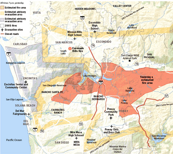
UPDATED 10/23/07 – 1831 PDT: This evacuation has been canceled. There is a mandatory evacuation in effect for parts of Del Mar west of Interstate 5: Here are the actual details: A mandatory evacuation order remains for all areas of Crest Road, and San Dieguito Drive, Oribia Road, Avenida Primavera along Crest Road, Serpentine Drive, […]

Read More

Harris Fire – day 2

Harris Fire – day 2

| October 23, 2007 | 1 Reply

The Harris Fire in southeast San Diego County is making the residents there increasingly nervous. As you can see from this updated (0530 today) map, the fire has moved beyond the evacuation area and is following Hwy 94 right up into Spring Valley: My sister, Jacque Hoffman, and her son Devon went up to the […]

Read More

Witch Creek Fire – Day 2

Witch Creek Fire – Day 2

| October 23, 2007 | 1 Reply

Update 09:30 Pacific Good news from the front – around the north half of the county the winds are calm now, and the air assault is taking place in full force. Dozens of water dropping aircraft are now engaging the Witch Creek Fire and the Harris Fire. There is some uncertanty how long this pause […]

Read More

Witch Creek Fire

Witch Creek Fire

| October 22, 2007 | 25 Replies

If you are looking for San Diego County fire news for Tuesday October 23, you will find it by clicking here. Update 22:00 Pacific This will be the final update of the night. Tammi and I went to go get a look at what was happening. In the dark you can better see the fire […]

Read More