Category: Visualizations

Rice Canyon Fire – Horse Evacuation Site

Rice Canyon Fire – Horse Evacuation Site

| October 24, 2007 | Reply

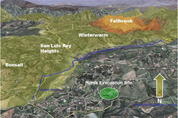
Using the KPBS overlay once again, this is a graphic that shows the position of where we moved the horses to last night relative to the Rice Canyon Fire burn area and evacuation footprint. For the moment it still seems to be safe, but I am somewhat nervous about the proximity to the evacuation areas. […]
Read More

Lake Hodges Funnel Graphic – 07:30

Lake Hodges Funnel Graphic – 07:30

| October 24, 2007 | 1 Reply

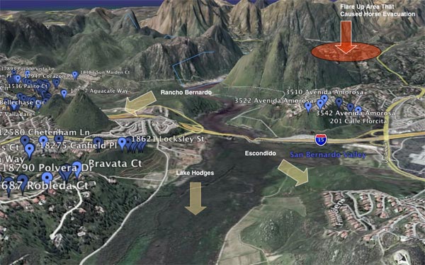
I have mentioned that on Monday the fire burned through the basin area between Rancho Bernardo and Escondido that holds Lake Hodges. With the winds blowing about 40 MPH, this area created a natural funnel and path for the fire to follow, and can largely explain the massive devastation of homes on either side of […]

Read More