Category: Maps

Rancho Santa Fe – Homes Spared By New Strategy

Rancho Santa Fe – Homes Spared By New Strategy

| October 25, 2007 | Reply

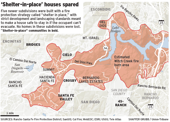
In an article in the Union Tribune, a new land use strategy has appeared to work. This is the “Shelter In Place” approach. From the article: Click graphic for larger view A disputed land-use strategy designed to protect new developments from devastation in the county’s exurban, fire-prone areas appears to have passed its first and […]
Read More

Union Tribune Updated Fire Graphic – 0650 PDT

Union Tribune Updated Fire Graphic – 0650 PDT

| October 25, 2007 | Reply

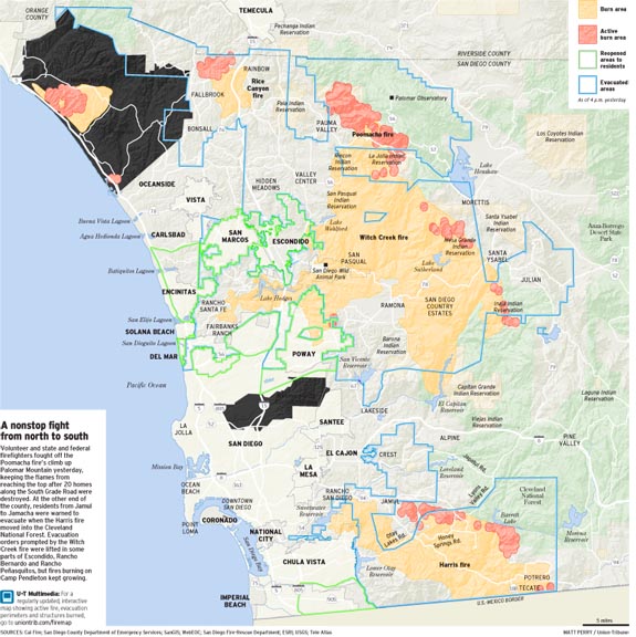
The San Diego Union Tribune has published an updated map / graphic of San Diego county showing the current active burn areas, and the total areas affected by the fires still active. Click map for larger view From the map, the Horno fire is clearly burning towards the Northwest across camp Pendalton, towards San Onofre […]

Read More

Overnight update — posted 0610 PDT

Overnight update — posted 0610 PDT

| October 25, 2007 | Reply

The shift in wind and weather continues to be reflected in the San Diego County’s Emergency Center fire and evacuation map (PDF file, posted as of 0230 PDT). Witch Creek/Poomacha Fires The Witch Creek, Guajito and Poomacha fires are shown as a single fire complex; almost all of the active spots are to the north […]

Read More

Harris Fire Maps – 17:45

Harris Fire Maps – 17:45

| October 24, 2007 | Reply

Last but certainly not lest, these are maps of the Harris fire from October 23rd at about 20:00 using the same IR platform as the other images. This is all geo-registered and layed onto Google Earth. None of these maps show the movement of the fires on the 24th (Wednesday), and I will update with […]

Read More

Witch Creek Fire Maps – 17:30

Witch Creek Fire Maps – 17:30

| October 24, 2007 | 3 Replies

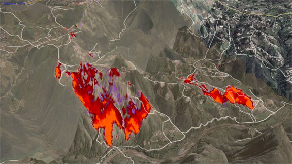
Same IR data source as before. All of the data is nicely geo-registered, and works well in Google Earth. The one caveat is that this data is all from October 23rd, so its from yesterday. Now some views of the Witch Creek Fire. You will note these are from all over the east part of […]

Read More

Rice Canyon Fire Maps – 17:00

Rice Canyon Fire Maps – 17:00

| October 24, 2007 | Reply

From the same data source, now a set of maps for the Rice Canyon Fire. A reminder this is thermal / infra-red imaging, so we are seeing “heat” here. IR at 20:00 Tuesday Oct 23 Looking East / North East IR at 20:00 Tuesday Oct 23 Looking West / South West Again this data set […]

Read More

Poomacha Fire Maps – 16:30

Poomacha Fire Maps – 16:30

| October 24, 2007 | 2 Replies

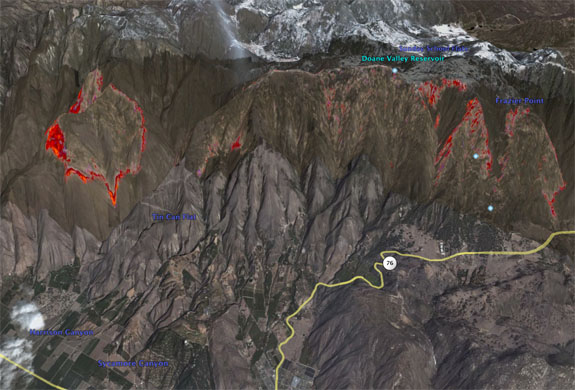
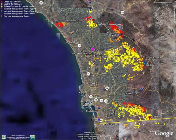
I have discovered a source of Infra-Red data to be used in mapping. The data is high quality and geo-registered which is very good news for accuracy. The bad news is it is a day old. However I wanted to show you what Poomacha looked like at 20:00 Tuesday Oct 23 Looking East / North […]

Read More

Poomacha Fire – 15:30 Update

Poomacha Fire – 15:30 Update

| October 24, 2007 | 1 Reply

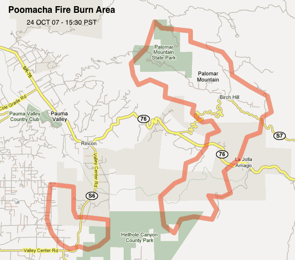
I have some data on the Poomacha fire burning near Mount Palomar in northeastern San Diego County. A map generated by SDSU / Grossmont was used together with Google Earth and Google Maps to produce this representation of my best guess of what has been burning. Not everything within the red lines is on fire […]

Read More

Another GeoSpatial Look At The Fires

Another GeoSpatial Look At The Fires

| October 24, 2007 | Reply

I would like to recognize another blogger who is working hard to cut through the lack of information and fog surrounding our multiple fires in San Diego County. The Blog is http://www.barboni.org/ and an example of the kind of work being done is shown below. Good stuff!

Read More

Harris Fire – 10:30 Update

Harris Fire – 10:30 Update

| October 24, 2007 | 1 Reply

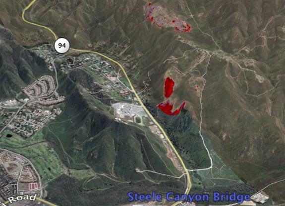
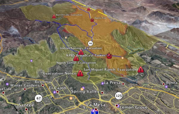
The Harris Fire is now 73,000 acres, suppression costs are at $2.5 million. There are 759 firefighters assigned. The fire was held at the edge of Chula Vista and Spring Valley. The returning onshore flow has moved the fire to the northeast threatening structures along Highway 94 from Jamul to the east and Jamacha to […]

Read More