Category: Maps

San Diego Fires update – winding down – 1510 PDT

San Diego Fires update – winding down – 1510 PDT

| October 28, 2007 | Reply

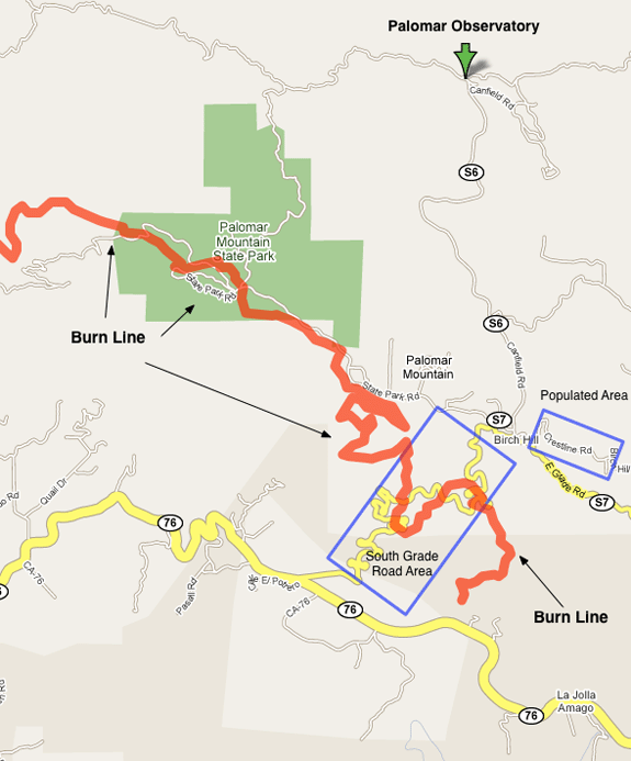
The San Diego County Emergency Center shows no active (i.e., intense) burn areas in San Diego County as of this morning. Most roads are open and most evacuations have been canceled, except for the area around Mt. Palomar and the area just south of it: The Sign On San Diego Fire Blog is reporting the […]

Read More

Witch Creek / Poomacha updated – 0500 am

Witch Creek / Poomacha updated – 0500 am

| October 27, 2007 | Reply

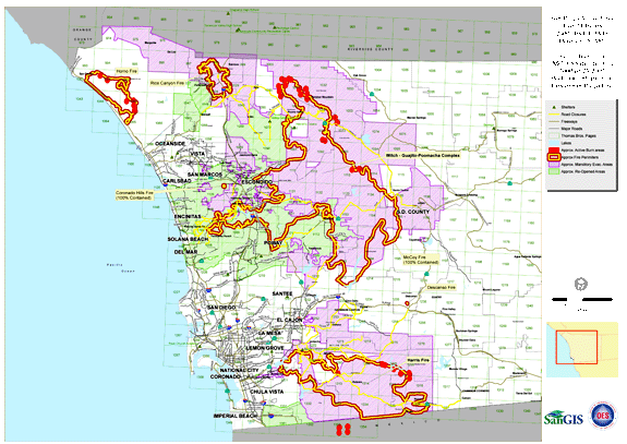
The latest San Diego County Emergency Center fire map show little active burning except in the northern section of the Witch Creek / Poomacha fire complex: As you can see, a lot of this is still up on Palomar Mountain. The San Diego County Emergency Center had this description of the Poomacha Fire as of […]

Read More

San Diego Fire News Round Up – 1230 PDT

San Diego Fire News Round Up – 1230 PDT

| October 26, 2007 | Reply

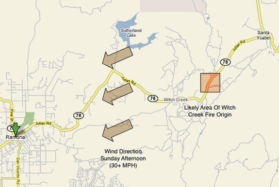
A collection of interesting news on the San Diego fires from our local media: Witch Creek fire fierce from start Bill Tulloch is a tough old cattle rancher. Even at 82, he thought he had a chance to stop the fire that was brewing on the northeast side of his property around noon on Sunday. […]

Read More

Poomacha Fire Update 1000 PDT

Poomacha Fire Update 1000 PDT

| October 26, 2007 | 1 Reply

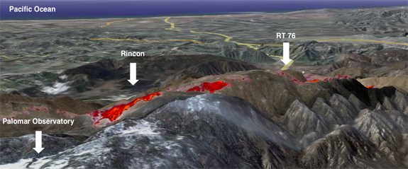
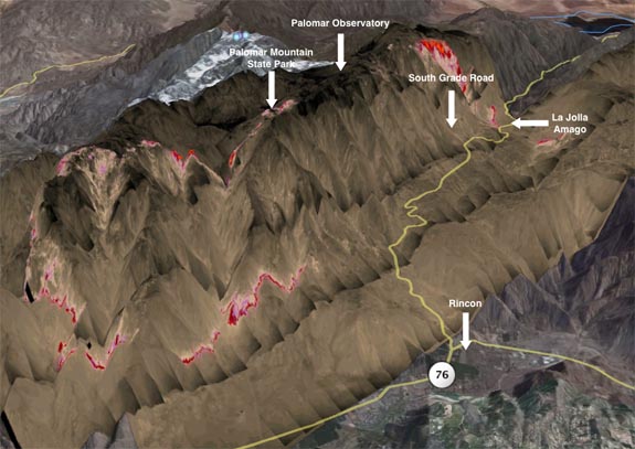
The Poomacha fire is still working hard to try and burn as much of Palomar mountain as it can, as shown in these images created from Google Earth merged once again with infra-red data from the Pacific Southwest Research Station. To create this kind of data, an aircraft flies over the fires with a special […]

Read More

Harris Fire – Lyon’s Peak 0900 PDT

Harris Fire – Lyon’s Peak 0900 PDT

| October 26, 2007 | Reply

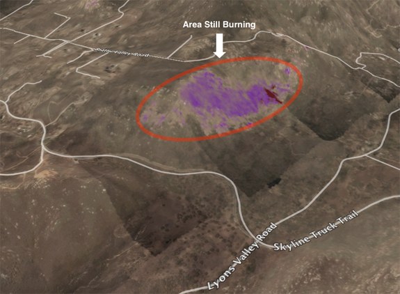
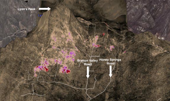
Though most of the county is working hard to get back to the regular routine of life, there are several hot spots to the fires still being battled. One is the Harris Fire near Lyon’t Peak. The image below was constructed using Google Earth and data from Pacific Southwest Research Station. This data is from […]

Read More

Friday Morning Fire News Round Up – 0630 PDT

Friday Morning Fire News Round Up – 0630 PDT

| October 26, 2007 | 1 Reply

The fires is San Diego are not yet out, but they are now burning mostly in the back country. There is still some threat to populated areas by the Harris Fire, Witch Creek eastern front and the Poomacha Fire. During this phase of the even information about the location and direction of the burn will […]

Read More

San Diego Tries To Go Home And Get Back To Normal

San Diego Tries To Go Home And Get Back To Normal

| October 25, 2007 | 1 Reply

Reports around the county are that most areas evacuated are starting to let resident back home. This is great news and is an important step to getting people and the community settled down and back to normal. Two exceptions to this are Rancho Santa Fe and Ramona. Excerpts from local news sources follow: Several residents […]

Read More

Palomar Fire Fight – 1030 PDT

Palomar Fire Fight – 1030 PDT

| October 25, 2007 | 3 Replies

Word comes again from the Union Tribune on the valiant fight to save the top of Palomar Mountain. Palomar Mountain is home to the famous 200 inch Hale Telescope, but it is also home to some 200 or so residents and a very nice state park and camp ground. Note: This map was made using […]

Read More

Harris Fire Update – 0830 PDT

Harris Fire Update – 0830 PDT

| October 25, 2007 | Reply

Again from the same IR source that was used for the Poomacha images. These IR images also display some of the banding artifacts that were seen on the Poomacha images, it is an artifact of the IR sensor. IR at 21:19 Wednesday Oct 24 – Lyon’s Peak Looking North You can clearly see the hot […]

Read More

Poomacha Fire Update – 0800 PDT

Poomacha Fire Update – 0800 PDT

| October 25, 2007 | Reply

The IR Source that I have been fond of did another sensor pass on the Poomacha fire last night. I now can show the extent of the burn on Palomar Mountain and near Rincon. For those of you wanting to look at the data yourself, you can find it at the Pacific Southwest Research Station […]

Read More