Category: SAN DIEGO EMERGENCIES

Harris Fire Time Lapse Video

Harris Fire Time Lapse Video

| October 25, 2007 | 1 Reply

Amazing chunk of video shot via time lapse of the Harris Fire as it burns towards Lyon’s Peak in eastern San Diego County. The video features time lapse composite shots from several of the cameras, each starting during a night time shot. For current view of the High Performance Wireless Research and Education Network (HPWREN) […]
Read More

San Diego Tries To Go Home And Get Back To Normal

San Diego Tries To Go Home And Get Back To Normal

| October 25, 2007 | 1 Reply

Reports around the county are that most areas evacuated are starting to let resident back home. This is great news and is an important step to getting people and the community settled down and back to normal. Two exceptions to this are Rancho Santa Fe and Ramona. Excerpts from local news sources follow: Several residents […]

Read More

Palomar Fire Fight – 1030 PDT

Palomar Fire Fight – 1030 PDT

| October 25, 2007 | 3 Replies

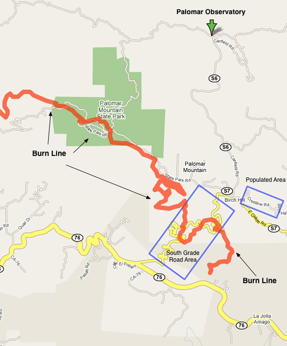
Word comes again from the Union Tribune on the valiant fight to save the top of Palomar Mountain. Palomar Mountain is home to the famous 200 inch Hale Telescope, but it is also home to some 200 or so residents and a very nice state park and camp ground. Note: This map was made using […]

Read More

The Blessing Under The Ashes

The Blessing Under The Ashes

| October 25, 2007 | Reply

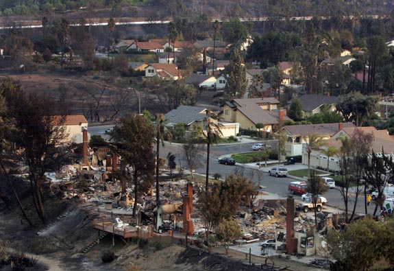
Photo credit SD Union Tribune The fires in San Diego County are still burning, but the worst has probably passed. At last count over 1,000 homes had burned in the fire, and word from the Union Tribune is that the first permit to rebuild was filed this morning. Prior to the fires, one of the […]

Read More

Harris Fire Update – 0830 PDT

Harris Fire Update – 0830 PDT

| October 25, 2007 | Reply

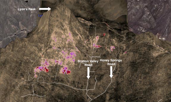
Again from the same IR source that was used for the Poomacha images. These IR images also display some of the banding artifacts that were seen on the Poomacha images, it is an artifact of the IR sensor. IR at 21:19 Wednesday Oct 24 – Lyon’s Peak Looking North You can clearly see the hot […]

Read More

Poomacha Fire Update – 0800 PDT

Poomacha Fire Update – 0800 PDT

| October 25, 2007 | Reply

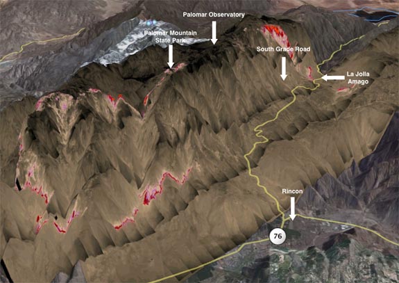
The IR Source that I have been fond of did another sensor pass on the Poomacha fire last night. I now can show the extent of the burn on Palomar Mountain and near Rincon. For those of you wanting to look at the data yourself, you can find it at the Pacific Southwest Research Station […]

Read More

Rancho Santa Fe – Homes Spared By New Strategy

Rancho Santa Fe – Homes Spared By New Strategy

| October 25, 2007 | Reply

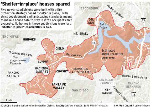
In an article in the Union Tribune, a new land use strategy has appeared to work. This is the “Shelter In Place” approach. From the article: Click graphic for larger view A disputed land-use strategy designed to protect new developments from devastation in the county’s exurban, fire-prone areas appears to have passed its first and […]

Read More

Union Tribune Updated Fire Graphic – 0650 PDT

Union Tribune Updated Fire Graphic – 0650 PDT

| October 25, 2007 | Reply

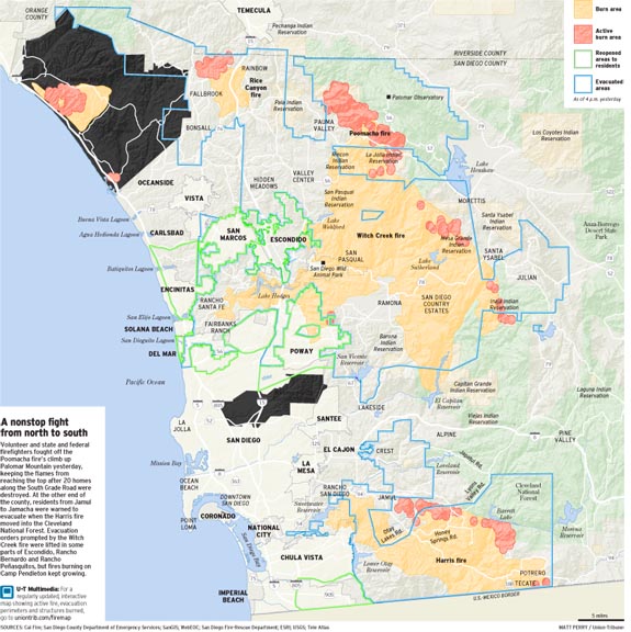
The San Diego Union Tribune has published an updated map / graphic of San Diego county showing the current active burn areas, and the total areas affected by the fires still active. Click map for larger view From the map, the Horno fire is clearly burning towards the Northwest across camp Pendalton, towards San Onofre […]

Read More

San Diego County – freeway and highway closures – 0630 PDT

San Diego County – freeway and highway closures – 0630 PDT

| October 25, 2007 | Reply

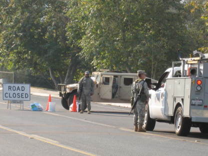
There is a lack of agreement among the various government agencies as to which freeways and highways are open or closed. The overnight fire/evacuation map from the San Diego County Emergency Center (PDF), dated as of 0230 PDT this morning, shows virtually all freeways and major highways in and out of San Diego County to […]

Read More

Overnight update — posted 0610 PDT

Overnight update — posted 0610 PDT

| October 25, 2007 | Reply

The shift in wind and weather continues to be reflected in the San Diego County’s Emergency Center fire and evacuation map (PDF file, posted as of 0230 PDT). Witch Creek/Poomacha Fires The Witch Creek, Guajito and Poomacha fires are shown as a single fire complex; almost all of the active spots are to the north […]

Read More